 INDIAN WONDERS
Rann of Kutch, Gujarat, india.
Dholavira is an archaeological site in Khadirbet in Bhachau Taluka of Kachchh district of Gujarat state, which has taken its name from a modern village 1 km south of it. The site of Dholavira, locally known as Kotada timba contains ruins of an ancient Harappan city. It is one of the largest and most prominent archaeological sites in India belonging to the Indus Valley Civilization. It is located on the Khadir bet island in the Kutch Desert Wildlife Sanctuary in Great Rann of Kutch. The site is surrounded by water in the monsoon season. The site was occupied from c.2650 BCE, declining slowly after about 2100 BCE. It was briefly abandoned and reoccupied until c.1450 BCE.
The site was discovered in 1967-8 by J. P. Joshi and is the fifth largest Harappan site in the Indian subcontinent, and has been under excavation almost continuously since 1990 by the Archaeological Survey of India. Eight large urban centers have been discovered: Harappa, Mohenjo Daro, Ganeriwala, Rakhigarhi, Kalibangan, Rupar, Dholavira, and Lothal.
The ancient site at Dholavira, is flanked by two storm water channels; the Mansar in the north, and the Manhar in the south. Archaeologists believe that Dholavira was an important centre of trade between settlements in south Gujarat, Sindh and Punjab and Western Asia.
Estimated to be older than the port-city of Lothal, the city of Dholavira has a rectangular shape and organization, and is spread over 100 hectares. The area measures 771.10 metres in length, and 616.85 metres in width. Like Harappa and Mohenjo-daro, the city is composed to a pre-existing geometrical plan, of three divisions - the citadel, the middle town and the lower town.
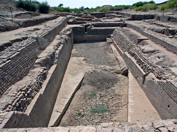
One of the unique features of Dholavira is the sophisticated water conservation system of channels and reservoirs, the earliest found anywhere in the world and completely built out of stone, of which three are exposed. They were used for storing the fresh water brought by rains or to store the water diverted from a nearby rivulet.
It is not known which language the Harappan people spoke, and their script cannot be read. It had about 400 basic signs, with many variations. The signs may have stood both for words and for syllables. The direction of the writing was generally from right to left. Most of the inscriptions are found on seals (mostly made out of stone) and sealings (pieces of clay on which the seal was pressed down to leave its impression).